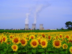
From the Rhone Glacier in Switzerland to the French Mediterranean Sea, this ride covers 850km (528 miles). The majority is on dedicated bike paths or secondary roads. Except for mountainous sections at the beginning, which can be easily avoided by using the train, or starting the ride further down the valley, the route is reasonably flat.
The route follows the Rhone Valley from the source of the river at Andermatt, Swizterland, down to Lake Geneva (Lac Leman), then out into France, to Lyon and then directly south to the Rhone delta in the wild Camargue.
The best map of the entire route through both Switzerland and France is Le Rhone a velo (ISBN 2970046504 only available in French). Cycling in Switzerland sell excellent guides to the nine Swiss national cycling routes (in French and German). National Route 1 follows the Swiss section of the River Rhone and is very well sign posted. A good map or GPS is essential for the French section of this ride.
There are plenty of tour operators who can provide guidance and support to those riders who prefer not to go it alone (see the ads on the right hand side for a few ideas). To make life easier for the independent ones, a detailed description of the route from Geneva to Port-Saint-Louis-du-Rhone (on the French Meditteranean coast) is provided on this website. It is broken into sections according to how we completed it in Spring/Summer 2006:
Geneva, Switzerland to Culoz,France - 67 km
Culoz to La Balmes les Grottes / Travers – 85 km
Travers to Lyon – 53 km
Lyon to Tain-l'Hermitage - 92.5 km
Tain-l'Hermitage to Viviers - 79.5 km
Viviers to Roquemaure - 67 km
Roquemare to Arles - 60km
Arles to Port-Saint-Louis-du-Rhone (42 kms)
An overview of the Swiss leg, which we completed during summer of 2005, is provided too:
Brig to Sion (75 kms)
Sion to Aigle (65 kms)
Aigle to Lausanne (60 kms)
Geneva to Lausanne (60 kms)
Tuesday, January 01, 2008
Sunday, April 22, 2007
Travers to Lyon (53 kms)
 There are a few hills in this stage, and the traffic to contend with in Lyon, but mostly the riding is easy. From Travers, continue along D65H, through la Brosse, and then briefly rejoin the D65. After 100 metres, take the D52A on your left, towards the lovely village of Hières-sur-Amby (7 kms). Ride through the village and then towards Bourcieu and Vernas (10 kms) on the D65E, which becomes the D65b after it crosses over the D65. In St. Romain de Jalionas (12.5 kms), take the D55 on your right, towards Chavanoz (16 kms). Keep following the D55 through Villette d’Anthon and Jons (24 kms).
 Cross the Rhone shortly after leaving Jons, going towards Nievroz (28 kms). Follow the D61 as you leave Nievroz, riding towards Thil (32.5 kms).
From here we followed the unpaved path alongside the river until Mirabel (40 kms), only running into a
 bit of trouble when we had to cross a pedestrian bridge with some of the walkway missing (it is possible to go around this if the bridge remains unfixed and proves too difficult to cross). For a paved alternative, take the D61b out of Thil up to the Route de Genève (N84), turn left towards Mirabel.
 Ride through Mirabel, turning left at the end of the village to cross the Pont de l’Ile. From here you can follow the bike path through the impressive Parc Miribel-Jonage and probably into Lyon. We left the path to stick with our GPS route, but I would expect one of them to go into the city and provide a safer passage. We arrived on a Sunday, so the traffic was light.
Culoz to La Balmes les Grottes / Travers (85 km)
 There are quiet backroads through the French countryside, quaint villages, and many opportunities to travel close to the river. This stage is reasonably flat and not overly difficult. However, on the day we did the ride, the headwind was strong, making it not as pleasant as it could be.
Crossing to the western side of the Rhone at either Seyssel, or Culoz, follow D992 to Belley (18 kms). As with many sections of the ride from here on, it is possible to follow the unpaved service roads on the banks of the Rhone for much of this part, if you choose.
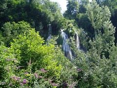 From Belley, head towards les Eccassas, Brens (24 kms), Chantmerie, then Peyrieu (30 kms). The next town to aim for is Murs-et-Gélignieux - you can get there from Peyrieu either by climbing over the hill, passing through the village of Fay, or following close the river on or near the D992. After Gélignieux (37 kms), take the D19c passing through la Bruyère and Brégnier-Cordon. In the next town, Glandieu (42 kms), there is a waterfall by the main road that is worth a stop. There are also some nice looking restaurants in town.
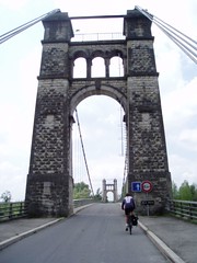 Continue on the D19 to St-Benoit (47 kms) and le Port de Groslée (50 kms). Here there are some nice parks on the banks of the Rhone, and a restaurant. Although it was after 1pm, and we were hungry, we kept going along the D19 to Flevieu, where we stopped for a nice lunch and refill of our water bottles. Keep following the D19 through Briord, Serrières-de-Briord (64 kms), the Barrage de Villebois, Sault-Brénaz (70 kms) and Saint-Sorlin (75 kms).
 Following the D40a, take the next bridge across the Rhone, towards La Balmes les Grottes (82 kms). This town has some famous caves that are probably well worth visiting. However, being time-limited, we pressed on to the accommodation we had booked in Travers (85 kms), conveniently located on the bike path. Here we stayed at the lovely chambre et table d’hôtes at
 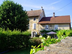 Chez Sylvie. The beautiful farmhouse and gardens of Sylvie and her husband Didier, provided a perfect place to rest, and to practice our French. The evening meal, eaten with the Didier family on their terrace, was absolutely fantastic, as was the breakfast the next day.
Saturday, April 21, 2007
Geneva to Culoz (67 km)
 This section takes you through the beautiful vineyards and countryside south of Geneva, then over the border into France. It is moderately demanding, with several steep descents and climbs, particularly around the Defile de l’Ecluse, where the Rhone squeezes through the Jura mountain range.
As you’d expect, there is a bit of traffic to pass through Geneva, but the bike paths are good. Once outside of the city, the countryside opens up into beautiful vineyards and villages. There was a nice restaurant in Laconnex, where we stopped for an early lunch.
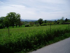
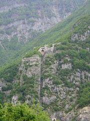 After Chancy (17kms), stay on the same side of the river, crossing the French/Swiss border before reaching la Joux. Once through Valliery (23kms), there is a great view across the canton of Geneva to the Jura. Leave the N206 to head towards Vulbens and Chevrier (32kms). At the Defile de l’Ecluse, stop at the lookout to see the view of the Fort d’Ecluse opposite, and the Rhone below.
 After a steep descent, and a corresponding climb, you reach the small village of Arcine (39kms). The next village to head towards is Clarafond, followed by Chêne-en-Semine, Challonges, and Veytrens D’en Haut, before reaching the beautiful town of Seyssel (53kms). There you should find plenty of places to eat, or stay.
 We went on to Culoz (67kms), in order to get the train back to Geneva (one of the few places where the route meets this train line). There is limited accommodation in Culoz, so if you’re planning to continue down the Rhone the next day, it’s better to stop in Seyssel.
Tuesday, April 25, 2006
Cycling in Provence
 The cycling season has started! To refamiliarise ourselves with our bikes, we have been on a few short rides around Geneva, but our first big adventure was to take the bikes down to Provence for the Easter weekend. Once there we attempted two short rides, the first of which I can highly recommend.
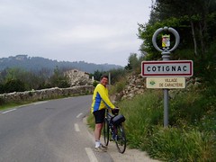
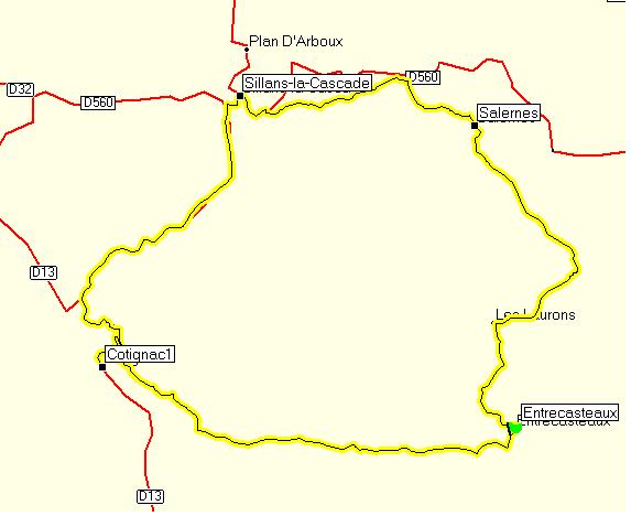 From the town of Entrecasteaux (department of Var), there is a nice 40km loop to Cotignac-Sillans la Cascade-Salernes and back to Entrecasteaux. Riding in this clockwise manner ensured it was all uphill until the halfway point at Sillans la Cascade, then downhill for the remainder.
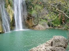 Sillans la Cascade was the perfect place to stop for lunch and a walk down to the waterfall (look for signs to La Cascade).
Overall, the roads we cycled on were quiet and in good condition. There are many other rides in the area, most of them with significant climbs. The Var cycling website (in French) provides details of all 22 routes.
 On Easter Sunday we drove down to St Raphael to try the 'Mediterranean Promenade' ride featured in The Lonely Planet's Cycling in France book. It was our first visit to the Cote d'Azur and although it's visually stunning in places, we found it crowded and not that pleasant. The coast road is narrow and extremely busy, at least on the Easter weekend. The houses are built right on the waterfront, so views to the ocean are interrupted. We got 12.5kms down the road then turned back. There are lovely restaurants on the beachfront and we had a delicious lunch overlooking the sea. It beat riding into a headwind with cars continually going past!
Sunday, September 04, 2005
We'll try that later
 The only section we have left to complete the Swiss cycling "Route 1" involves riding over the Furkapass, a very steep climb. We're not quite up to that yet, so we're putting it off "until we're fitter". In the meantime, we have been spending spare weekends cycling around the canton of Geneva and discovering a side to the place that we weren't aware existed.
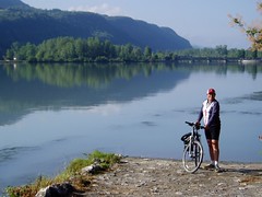
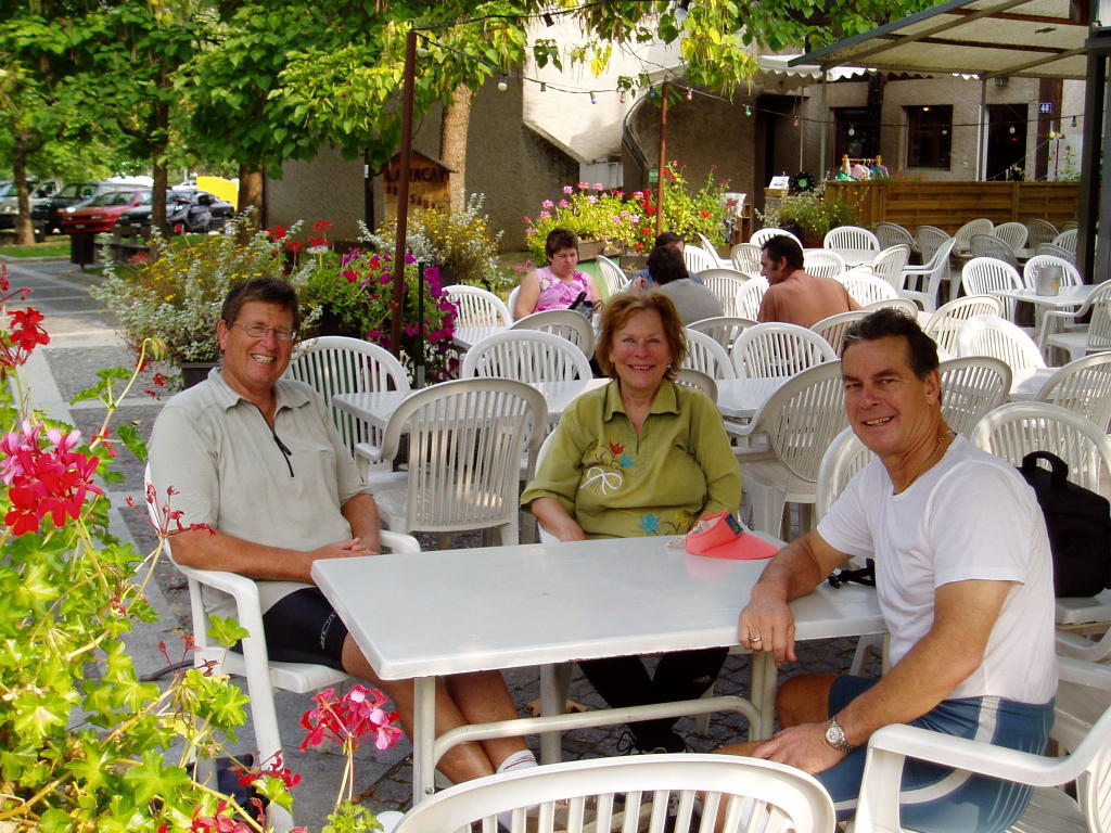
 Yesterday we were accompanied by our friends Bob and Zydre. The picture shows us having a coffee break in Vernier, which is a gorgeous village but unfortunate to be under one of the flight paths from the Geneva airport.
 The canton (state) of Geneva has a large wine growing district called Satigny that was our destination. We resisted the temptation of the numerous wineries and stuck to cycling amongst the vines. We had lunch on the banks of the River Allondon near Russin, then headed around through Peney to Vernier, then back into the city.
 The path we followed for most of this 43km ride is "Route 102", which starts from the back of Cornavin Railway station in the Geneva city centre. An excellent day's ride, without a mountain pass in sight.
Why not to buy a cheap bike rack
Straight after our glorious achievement of cycling 140kms in one weekend, disaster struck. As we were driving home with our bikes strapped on the back of the car, they flew off and crash landed in the middle of the road. Thankfully no-one was driving behind us and we managed to drag them off the road before causing problems for fellow motorists. The bikes were in pretty bad shape, with Peter's coming off far worse than mine.
After getting over the shock, the challenge was to find a bike repair shop with someone who could speak some English, or at least guess from our miming abilities that we wanted them to check our bikes and quote on repairs.
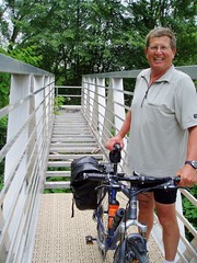
 After one failed attempt, where we managed to get our perfectly good tyres and tubes replaced but no fixing of the buckled wheels, we found a shop that could help us. They declared Peter's bike a write-off and mine repairable, which made Peter very happy as he had the perfect excuse to invest in a new bike (pictured).
We're now back on the road and Peter is very pleased with his new Swiss bike. The crappy bike rack has been ditched (although it was not entirely to blame) and for now we'll be depending on trains to get our bikes from A to B.
After getting over the shock, the challenge was to find a bike repair shop with someone who could speak some English, or at least guess from our miming abilities that we wanted them to check our bikes and quote on repairs.
 After one failed attempt, where we managed to get our perfectly good tyres and tubes replaced but no fixing of the buckled wheels, we found a shop that could help us. They declared Peter's bike a write-off and mine repairable, which made Peter very happy as he had the perfect excuse to invest in a new bike (pictured).
We're now back on the road and Peter is very pleased with his new Swiss bike. The crappy bike rack has been ditched (although it was not entirely to blame) and for now we'll be depending on trains to get our bikes from A to B.
Sunday, July 31, 2005
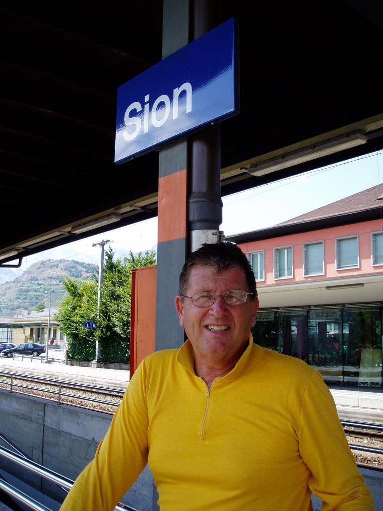
Sion to Brig (75 kms)
 With sore legs from the day before, we set off around 9am to ride from Sion to Brig. The cloudy weather cleared in the late morning, making for a beautiful day. This section of Route 1 continues along the Rhone valley through orchards, vineyards and industrial areas. As the valley narrows, the path rejoins the road in spots and takes you through quaint (and very quiet) villages.
A particular highlight is the beautiful lake at Sierre. We found it taking a detour to avoid a hilly on-road section, along with a gorgeous looking restaurant, swimming pool and picnic area. We got to see it twice as we had to double back and go up the hill after all (which wasn't as hard as it looked).
In the latter half of the ride, you enter the German speaking part of the country, with signage changing from familiar French to unfamiliar German. Despite speaking absolutely no Swiss-German, we managed to order a fantastic lunch from a restauranteur who spoke no English (pointing and smiling seems to work).
 The ride ended around 5.30pm at Brig railway station where we got icecreams and prepared to take the 5.59 train back to Sion for another night in our little tent. This section of the ride was 75km, a personal best for Jess who before arriving in Switzerland had never ridden for longer than 60kms in one go. We completed this at a fairly slow pace, taking about 4hrs and 50 minutes of riding. More photos on Flickr.
Saturday, July 30, 2005
Aigle to Sion (65 kms)
 July 30: Well it's been a long time between drinks, but with our July visitors now dispatched, we have a spare weekend to continue our ride. Monday 1 August is a holiday in Switzerland (Swiss National Day), so with a long weekend ahead of us we decided to do two consecutive days of riding, camping at the middle point: Sion.
We packed up on Saturday morning, arriving at our campsite around 2pm due to heavy traffic around Montreux. It was after 3pm when we finally set off on the day's ride. Rather than choosing to ride down the valley, we decided to catch the train to Aigle to ride back up, taking advantage of the strong tailwind in that direction.
The ride from Aigle to Sion continues alongside the River Rhone, far from busy roads for most of the time. We got caught in heavy rain in St Maurice, but used this as an excuse to stop for coffee and icecream in one of the cafes there. It was after 8pm when we finally reached our campsite, feeling happy, hungry and tired. A hot shower, ham and cheese sandwiches from the campground 'supermarket' and a glass of wine, were welcome rewards after a busy day.
This leg of the ride was 65km and took us about 3hrs and 40 minutes, not counting a few breaks along the way. More photos on Flickr.
Subscribe to:
Posts (Atom)